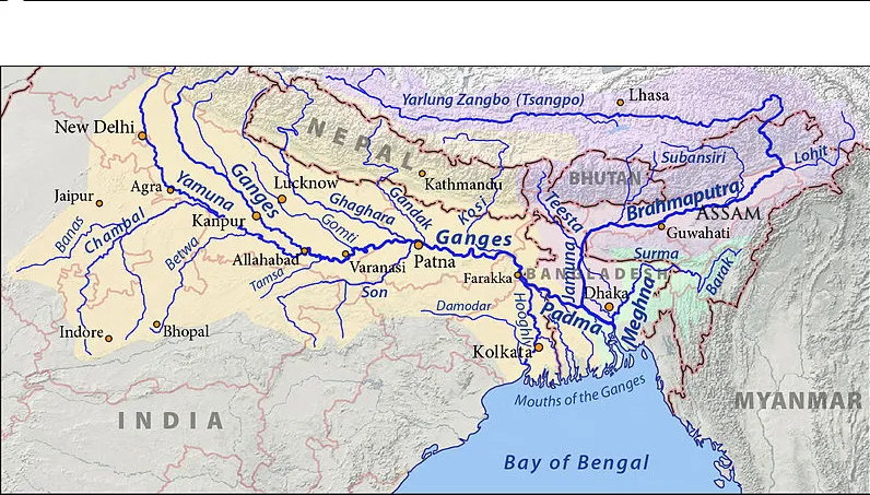
The Tsangpo-Brahmaputra River travels through Assam and is one of the largest rivers by volume discharge in the world. The Brahmaputra remains largely uncontrolled, although Bhutan has recently built several dams for hydropower generation.
Flooding and erosion are well-known and well-studied problems in Assam. However, because Assam is in the downstream portion of the Brahmaputra, much of the system’s hydrology is dictated by what occurs upstream. Our expertise in large-scale hydrology, both physical and statistical, is aiding the ASDMA to cope with both flooding and erosion as well as assessing risks with changing climate. Future economic development choices need to consider climate, flood risk and erosion. This work will help the state of Assam, and particularly the ASDMA, to make informed policy choices with regard to how best to develop water storage, directions for energy capacity expansion, and directions of food policy while addressing the potential climatic impacts on floods, droughts, agricultural productivity and human health. Developing the capacity to shed light on these choices through hydrologic modeling, informed by field investigations and interaction with key local experts and decision makers, will fill a much needed gap and provide an analytical basis for decisions in a critically stressed region.