The Everglades
CWC's research in the Everglades research focuses on developing innovative tools that allow climate scenarios of high resolution rainfall and temperature to be developed integrating historical climate data and future climate predictions.
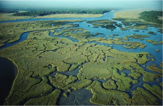
The Everglades is one of the largest and most diverse wetland ecosystems in the United States, stretching nearly 130 miles from Lake Okeechobee in Central Florida to the southern tip of the state.
The pressures of agriculture and development, however, have greatly degraded the system. Today the Everglades is half the size it was 100 years ago, and many keystone species are threatened, including the Florida Panther and the American Crocodile. Since the 1930s the Everglades has seen an 80 percent decline in wading bird populations, and a serious worsening of water quality in Florida Bay from decreased freshwater inflows.
The ecological difficulties of the Everglades are further complicated by the threat of climate change; the entire system lies at or very close to sea level, which means that sea level rise could push saltwater inland resulting in unknown ecosystem consequences.
In 2000, the Army Corps of Engineers and the South Florida Management District launched the Comprehensive Everglades Restoration Plan (CERP), an ambitious multi-organization program to restore the ecological health of the system. The Columbia Water Center partnered with CERP to systematically analyze the potential impacts of sea level variability on the Everglades as well as the effects of long-term changes in precipitation. The Water Center’s work was supported by the Critical Ecosystems Studies Initiative of the Everglades National Park.
While the significance of long-term, (multi-decadal) global climate change is now widely recognized, from a practical perspective, water managers need to combine longer-term projections with shorter-term regional forecasting to make appropriate allocation and infrastructure decisions.
Our research has focused on developing innovative tools that allow climate scenarios of high resolution rainfall and temperature to be developed integrating historical climate data and future climate predictions. These scenarios at the seasonal and longer time scales are being used to design release management strategies to improve bird habitat and nesting success while maintaining urban water supply and flood control.
The central emphasis of CWC research in the Everglades was to devise more accurate and regionally specific forecasting tools that incorporate information across multiple timescales–including multi-decadal climate change, decadal natural variability mechanisms such as the El-Nino Southern Oscillation and the North Atlantic Oscillation, as well as higher frequency phenomena such as tides, storm surges, pressure changes and ocean currents.
Incorporating this kind of regional and multiple-timescale climate information is essential in the design and operation of a sustainable freshwater release network for a sensitive ecosystem such as the Everglades National Park. Through this research, the CWC provided Restoration Plan Managers with the most useful tools to anticipate medium-term, regional climate trends so they can implement the restoration project accordingly.