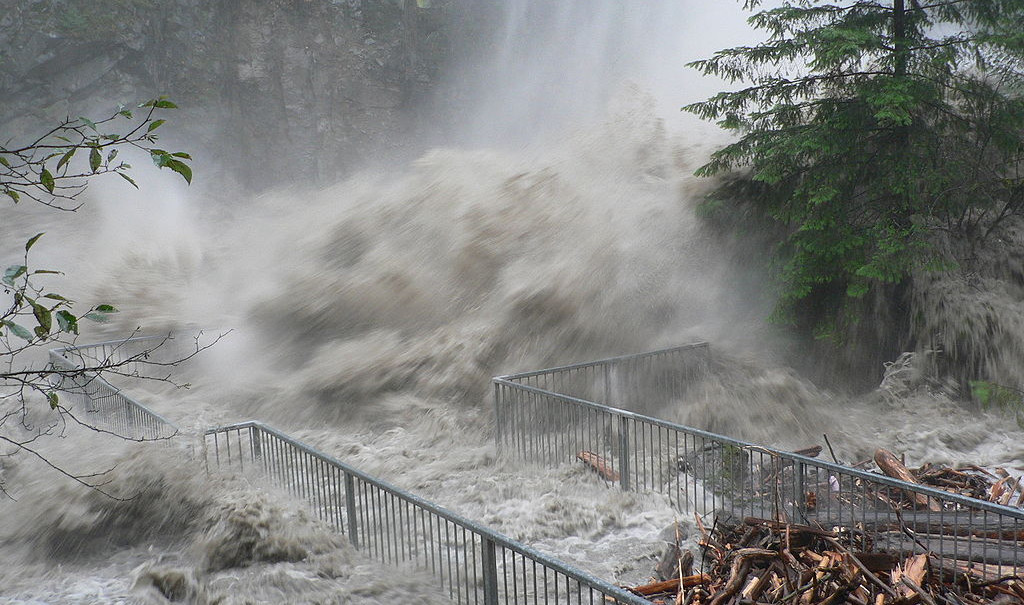
Columbia Water Center scientists are currently pursuing a number of projects to map and correlate flood risk. This research offers the possibility of predicting and managing flood disasters as the interconnected, global phenomena they are rather than stationary, isolated and random events. While we will never prevent loss from floods entirely, new climate research and prediction along with innovative financial mechanisms offers the opportunity to more intelligently manage these catastrophic events.

Medium and long-term climate predictions are useful for infrastructure design and the development of flexible water management procedures. Shorter-term predictions give response teams time to adequately prepare for an event. Finally, the portion of risk that cannot be predicted or managed through infrastructure and planning mechanisms alone could be addressed by financial risk management tools such as insurance and catastrophe bonds.
Taken together, these approaches allow for a comprehensive, interdisciplinary approach to flood and drought management across multiple time scales and affecting diverse stakeholders.
Probabilistic Forecasting for Disaster Preparedness
In spite of great improvements in medium-term climate prediction and forecasting in recent years, coordinated application of climate data to disaster risk management remains in its infancy. Nevertheless, there is broad agreement among disaster management professionals that an increased focus on proactive approaches to disasters is urgently needed. Some examples of how better climate forecasting on different timescales can be applied to disaster preparedness include:
- Short term warnings with a high degree of certainty (for example a cyclone or hurricane warning) that allow residents to evacuate and response teams to prepare. A response delay of even a few hours can have terrible consequences in a disaster. Decision systems to support these actions need to be integrated with the forecast system.
- Earlier, less certain warnings of up to a month in advance. Such warnings can allow responding agencies to pre-deploy equipment (such as tents, blankets, water purification tablets, etc.). If the potential disaster is particularly large, a monthly prediction can allow response teams early warning to apply for visas.
- More extended, seasonal warnings, which can be tailored to disaster events, can guide activities such as crop selection, or even work patterns for the upcoming season (farmers whose profits might be impacted by an extreme event could choose to migrate seasonally to the city, for example). At the operations level, such forecasts can allow reservoir managers to make better-informed decisions about water releases.
Longer-term, multi-decadal forecasts of climate variability (is a given area entering a wet or dry period?) coupled with global climate change allow for the possibility of better decisions about infrastructure design, sizing or other longer-term land-use and zoning issues that affect the vulnerability of populations.
Infrastructure Design and Management for Flood Regimes
Understanding the “regime-like,” dynamic risk of floods over time is crucial if policymakers are to design and manage flood infrastructure appropriately. Most flood management design for extreme events is based on the “100-year” flood—the flood level that has a 1 percent chance of being reached or exceeded in a given year. Past predictions of the level of the 100-year flood assume that on average flood risk does not vary over time, and therefore the level of risk can be determined from data collected over relatively short periods of time.
Increasing evidence, however, shows that this assumption is incorrect, and that, following climate, flood occurrence exhibits a “regime-like” pattern in which there are long-term, quasi-periodic and cyclical trends of wetter and drier periods. This evidence suggests that if designers of reservoirs fail to anticipate longer-term climate cycles, they are misinformed as to the risk of flood.
Financial Mechanisms
The development of better climate-prediction models allows for new, innovative insurance mechanisms to help people and governments adapt to extreme flood events. Such mechanisms can become an important part of flood risk management.
Index insurance is an instrument through which payment to the insured is linked to the performance of a particular, mutually agreed upon index, such as precipitation or temperature, rather than to actual loss. As such it holds several advantages over traditional insurance, especially for developing regions. Traditional insurance, in which the insurer must visit or otherwise verify each claim individually, comes with high transaction costs, especially in relation to the premiums and expected payouts in developing regions. By linking payment to an index, an insurance company does not have to go into the field to evaluate losses. Thus, it saves money and payouts can be sped up.
While there is a growing interest in index insurance as a means to spread risk and help rural communities in the developing world, a number of barriers to implementation have arisen, including the availability and reliability of climate data.
The main problem with index insurance is that of “basis risk” – that is, the risk that payouts based on indices will not match actual losses. If the basis risk is too high it will either make the insurance either uneconomical for the insurer or unviable for the insured. Basis risk for index insurance is much higher on very small scales – in any given flood or other catastrophic event, one farmer could experience total loss while his neighbor survives. However, when losses are averaged across a nation or region, the correlation between index measurements and actual losses is much closer, and the basis risk lower. Therefore, index insurance may be most appropriate when applied to an aggregate user, such as a regional lending institution. Using indices to insure such institutions against the defaults they experience during an extreme event allows those same institutions to insure farmers individually.
Our researchers work with insurance partners to develop climate forecasting and risk analysis instruments that can be used to reduce extreme flood risk for large populations. New risk models allow insurance companies and their regulators to design better index insurance policies for flood risk management. Insurance, used in conjunction with short, medium or long-term forecasting, infrastructure design and management and enhanced preparedness then becomes a critical tool to help communities manage extreme flood risk.
